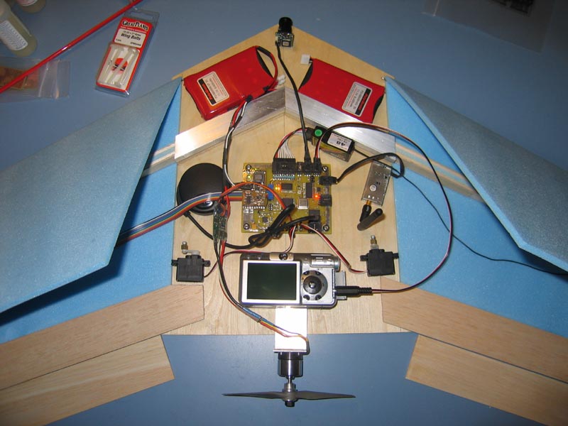
Our GPS Guided Autonomous Photography Airplane project is an Unmanned Aerial Vehicle (UAV) that we are very interested in completing successfully. We have a strong personal interest in remote controlled aircraft, and in Advanced Digital Signals Laboratory last semester we built a flying wing and control systems to fly it from a laptop computer with a wireless video camera mounted on the front of the airplane. Now we want to take this airplane to the next level, being fully autonomous. We feel this is an ambitious project that will push us to advance our skills in controls, signal processing, and artificial intelligence.
Our main goal is to develop a UAV that once launched will autonomously climb in altitude, fly to the preprogrammed coordinates, take photos of the area, and then return safely to the takeoff location. This would be useful for the government in aerial reconnaissance or search and rescue; or commercially for mapping, artistic photography, or land marketing. It would also provide a low cost alternative to hiring a manned airplane and would not require any extensive knowledge to use.
Benefits
- Low cost.
- Ease of use.
- Safer than sending a real pilot (zero human expense in military terms).
- Faster than manned aircraft.
Features
- Onboard digital camera for aerial still images.
- Onboard camera and 2.4GHz transmitter for real time video.
- Onboard control system capable of switching from manual control to completely autonomous flight at the flip of a switch.
- Fast deployment – can be ready to launch within seconds.
No comments:
Post a Comment